
Daybreak Meyersdale. The old adage – early to bed and early to rise – rang true, but just to be on the safe side we indulged in bottomless coffee refills at the town diner, putting down a greasy spoon breakfast in between sips. This seemed to be the equilibrium point, we were both feeling good and ready to ride, with no lingering aches and pains to keep an eye on. Day three was before us, and the route map was punctuated by numerous sites along the GAP that seemed worth a stop. More important, it was also the last day of any real uphill cycling, and the eastern continental divide was less than an hour out. Geared up, locked in, and full of caffeine, we got underway in the early morning.
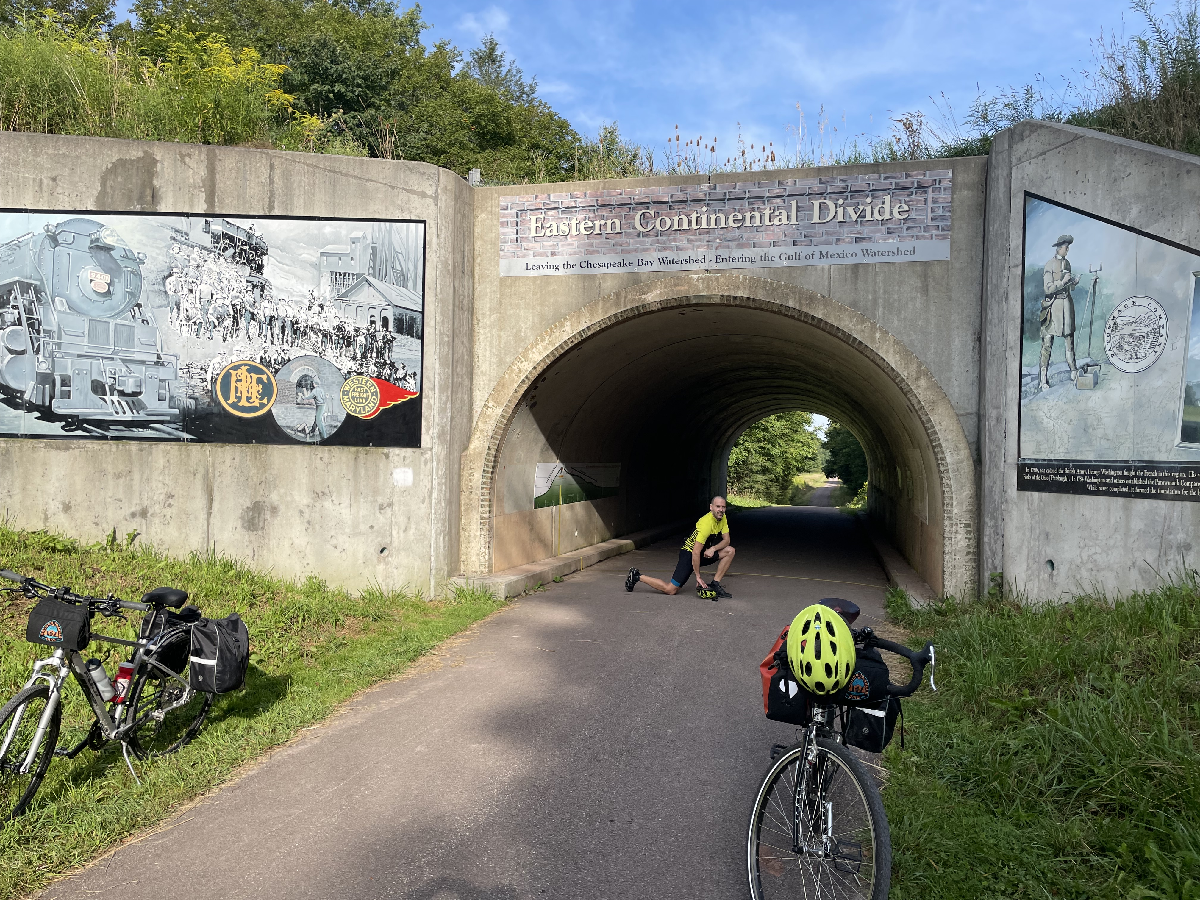
The divide was so close as to barely give us time to warm up before hitting it. It is a funny monument, paintings and signage affixed to what is by all other accounts an underpass of a road. I’m somewhat skeptical that this was the exact point where the waters diverged but we had no means to test it and see what ended up in the Gulf of Mexico or the Atlantic, so we were left to take the hoardings at their word. The path continued, inevitably, for a bit before we hit upon the next major marker, the Big Savage tunnel, through the eponymous mountain. Spanning almost 2/3rds of a mile, it is a singular experience to take a bike through the cool stillness and unnatural quiet, with nothing but a far point of light ahead. Woe again to the railroad crews tasked with blasting out this hole in the rock. I’m not sure if they’d be delighted or disappointed with how it’s used today, but at the least, probably surprised.

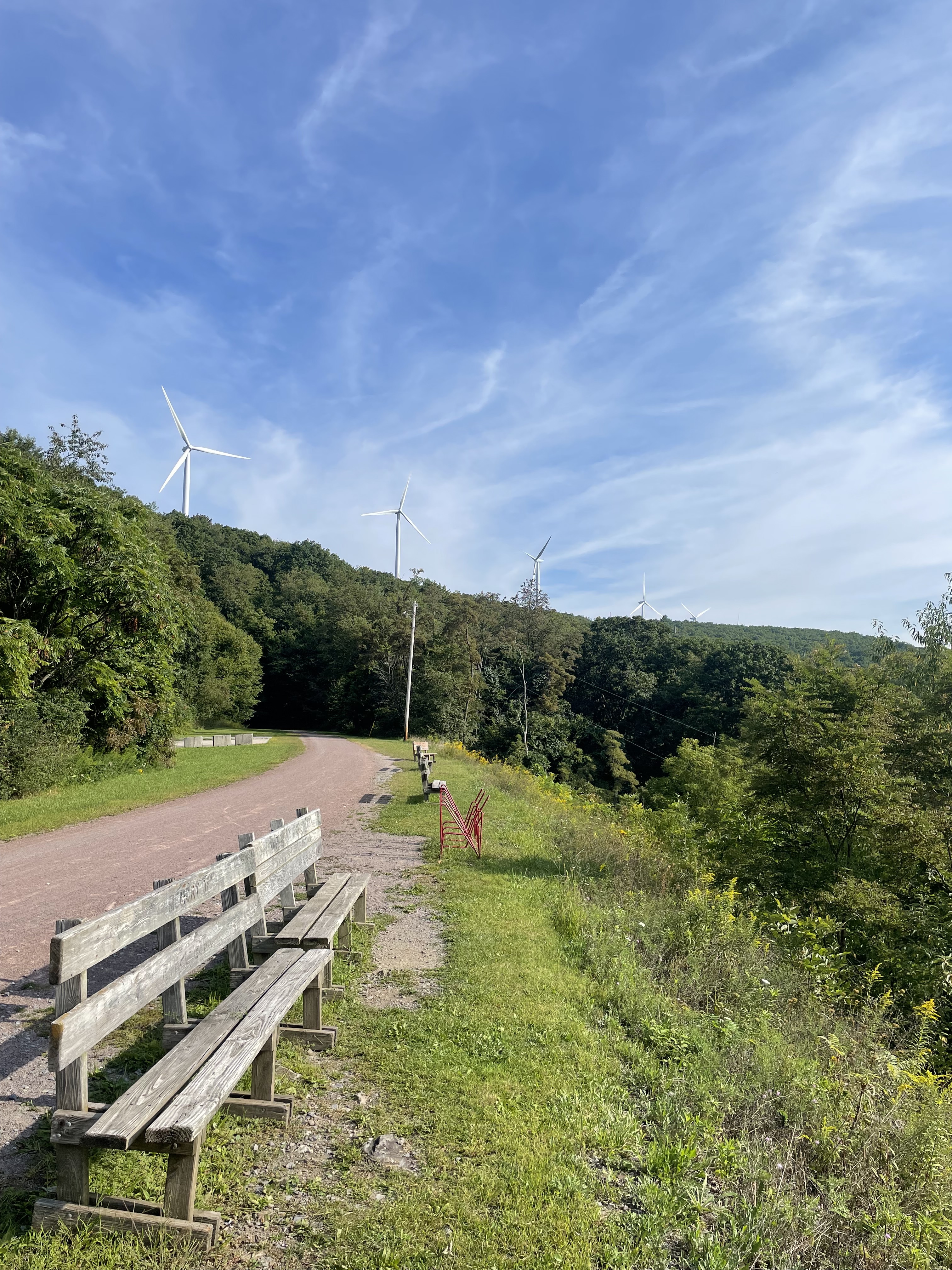
This too was the first figurative glimmer of light for our journey, and the Big Savage opened out into an honest, proper vista of the low Appalachian mountains rolling off into the foggy morning. Proof positive, in a way the continental divide couldn’t offer, that we were indeed going to be going downhill. Not ten minutes down the path was the Mason-Dixon line, memorialized most notably in junior high history classes across the country during students’ first pass through the Civil War. Said line was named for the pair of surveyors who mapped it, putting to rest border dispute between amongst the mid-Atlantic colonies in the 18th century. Or so the plaque told us. Without more ceremony than that, we rode over it and onward into Maryland.

Even more exciting than this geopolitical remnant of early American history was the long, soft downhill grade through Frostburg and on into Cumberland. After two days of gently climbing on our bikes, it was a thrill to do the opposite, and to get more speed for less effort with each crank of our legs, an hour and a half of blissful riding, all buoyed by the prospect of lunch at the end. As we rode down, we passed by groups climbing up to the tunnel, their set determination a repeated reminder that we were getting the better end of this deal. Over a halfway point lunch in Cumberland, feeling energized, we opened a debate: finish out our day in Paw Paw, per the plan, or push onward to Hancock, another 30 miles down. Our ride plan had been a simple construction: five days, each about 95 km (60 miles), with one big day of 160 km (100 miles). Tomorrow, day four, was supposed to be our big day. We wondered now if we should take advantage of our easy downhill morning and make the big push today.
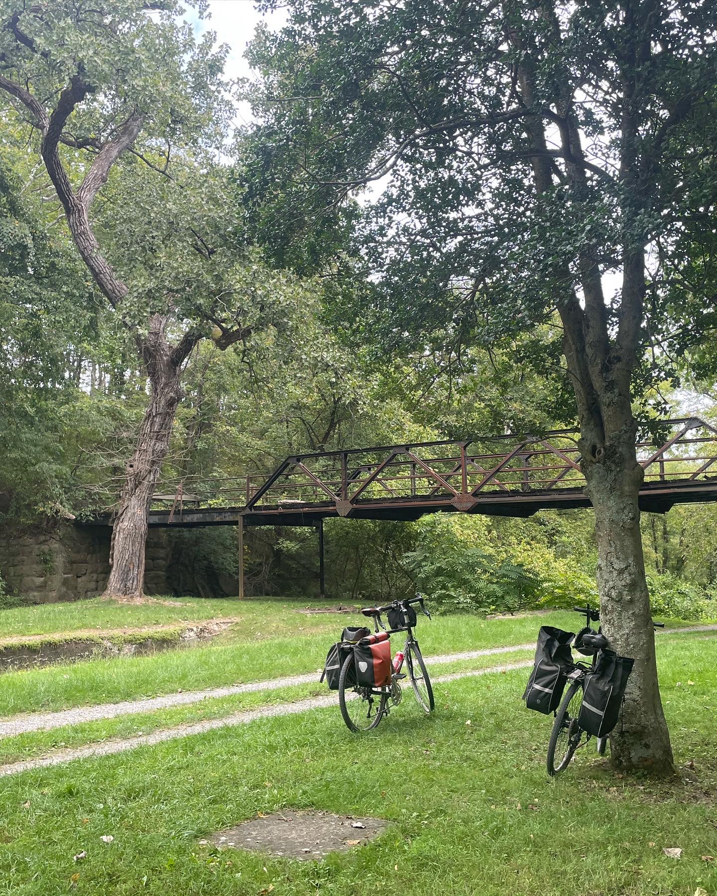
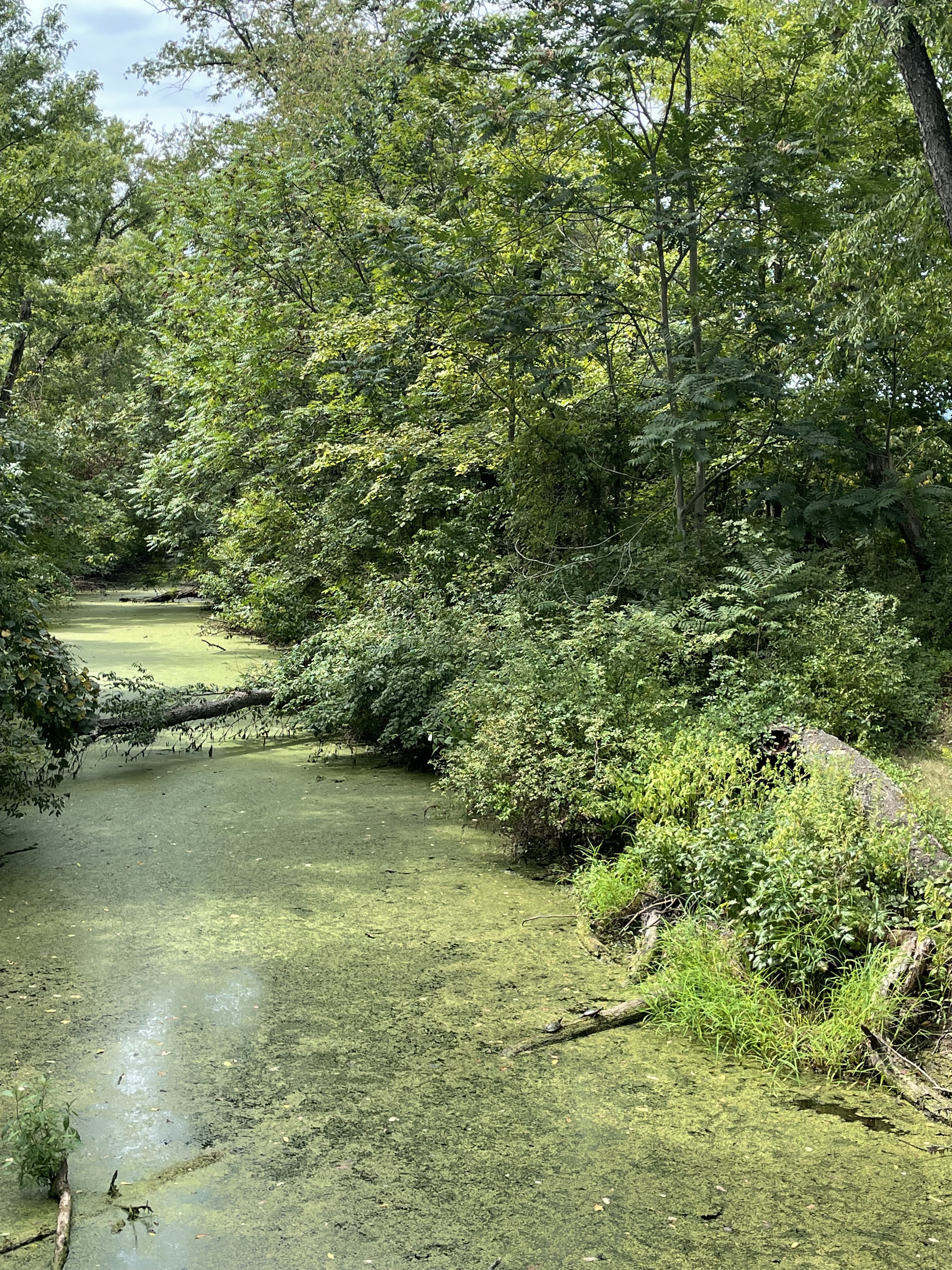
Cumberland was also significant as the end of the GAP. Here the trail transitioned from the wide former railroad to the narrow towpath of the old Chesapeake & Ohio Canal, the C&O. We had been told by a few fellow trail cyclists, somewhat ambiguously, that each trail had its own personality. The C&O is smaller, built to fit a team of mules, running parallel to the oxbows of the Potomac River. For much of the way, it is a coarser gravel, tougher sledding for the bike, but also more contemplative and quiet. Two tracks mark it, and we would switch sides depending on where the most potholes were. To the left, inevitably, were the remnants of the C&O, quickly being filled in by nature in the century since it was last used for commerce. In parts a shallow green ditch, filled with alders and underbrush, other times green algae covering still water with countless turtles basking on logs in the summer sun. We were accompanied by the constant hum of cicadas, the darting songbirds around the paths edge and the aimless butterflies stirring in the dirt near our wheels, oblivious.
Overall it made for an easy ride and we reached the bridge to Paw Paw as planned. Having punted our choice earlier, we again conferred. The upcoming Paw Paw tunnel was closed, meaning an arduous detour up and over the hills with our gear. In spite of this, we opted to keep going, and about fifteen minutes later, pushing a laden bike up a steep, root-strewn path, I questioned this decision. At the top of the detour we fell into conversation with another cyclist who we’d been leapfrogging back-and-forth since Cumberland. He took a plug of chew and mentioned Bill’s Place, a trailside watering hole halfway between here and Hancock, our new end point. Safe in the knowledge that we could get more water and Gatorade, we carried on down the path, a series of winding switchbacks which seemed designed to test my nerves. A few minutes later we were underway again on the flat, comfortable C&O, the detour behind us.
The ride into Hancock went smoothly, our only stop the liquids top-up at Bill’s Place in Little Orleans where we received a side-eyed look from leather-clad bikers (not cyclists) huddled over a too-small table. The big ride was behind us now, after nearly eight hours on our bikes, and we celebrated with Pizza Hut takeout and hotel room TV, our options being limited in the town. I slept soundly and awoke to truly the saddest continental breakfast I’ve ever had – empty coffee urns, cereal dispensed into styrofoam bowls, and Hostess snacks pulled from their boxes and set in a clear plastic case. We topped up with a grocery store stop before pulling out, the depressing breakfast offerings more than made up by knowing that we were now well past the halfway point.
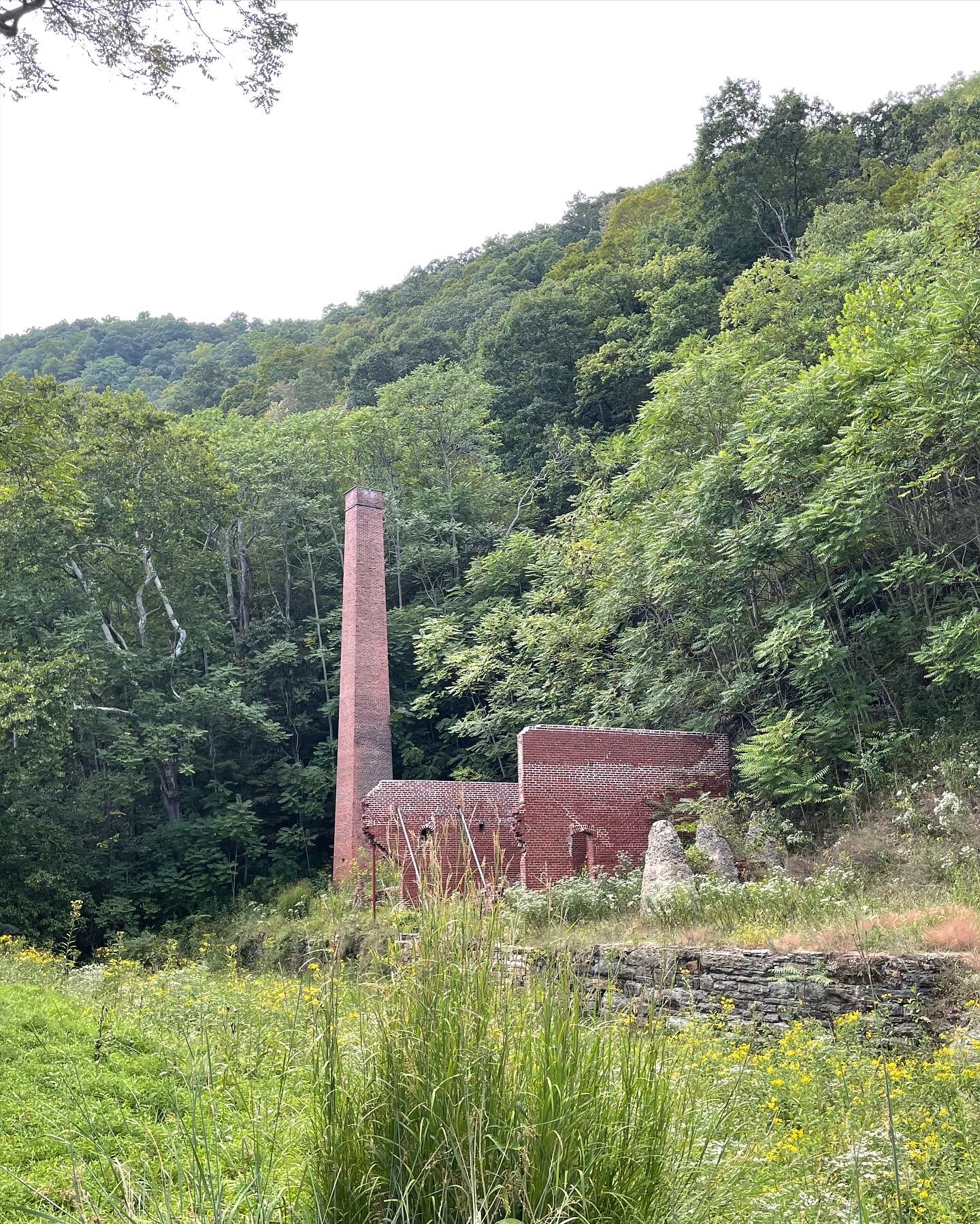
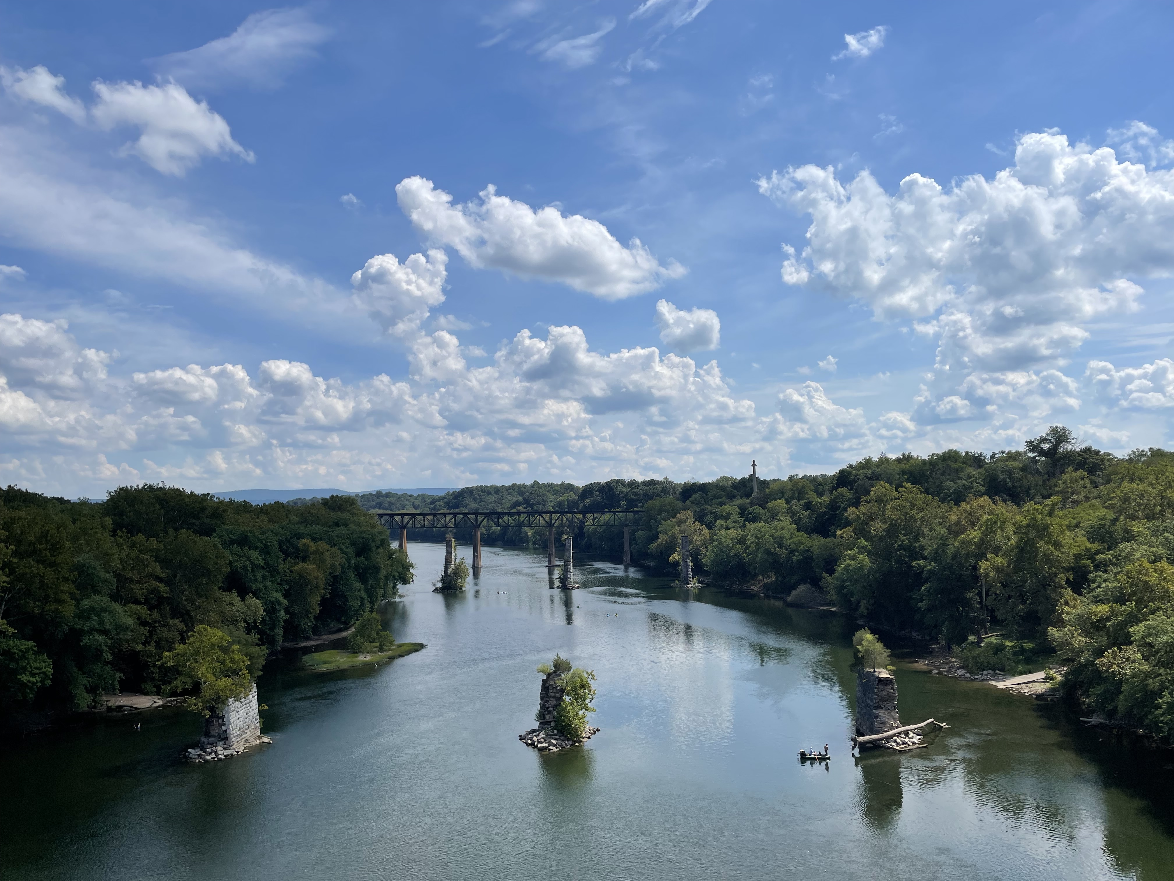
Deer crowd the C&O in the morning, and before 9 or 10 you come across them frequently. Their big eyes stare at you from ahead, unsure what to make of the bikes or the ringing bells. In some cases, you get quite close before they dart into the underbrush. For day four, they were the big excitement, and we enjoyed a steady day of pedaling under the tree canopy. Every so often we’d pass old canal locks and houses, old factories, and the occasional aqueduct – artifacts from a different time that now make for convenient rest stops and photo ops. We went nearly 70 km before breaking for lunch in Shepherdstown, across the Potomac in West Virginia and from my brief experience a charming small college town with a good bookstore and decent Thai food.
We knew we were near Harpers Ferry an hour later when the trail grew dense with weekend hikers and visitors to the historic town, meandering in mindless diagonals to and from the trail edges. This meant lots of bell-ringing and hauling our bikes up a twisting stairwell to cross into West Virginia again. Harpers Ferry, at the confluence of the Shenandoah with the Potomac, is situated on a steep hill and I angrily cursed this fact as we sought out and found our guesthouse, a family home turned B&B from the 1700s seemingly held up by inspirational Bible verses plastered on the walls above the creaking wooden floors. So far we’d been lucky with the weather, but tomorrow afternoon thunderstorms were expected. We set our alarms to 5:30 and hoped our luck would hold one more day.
