
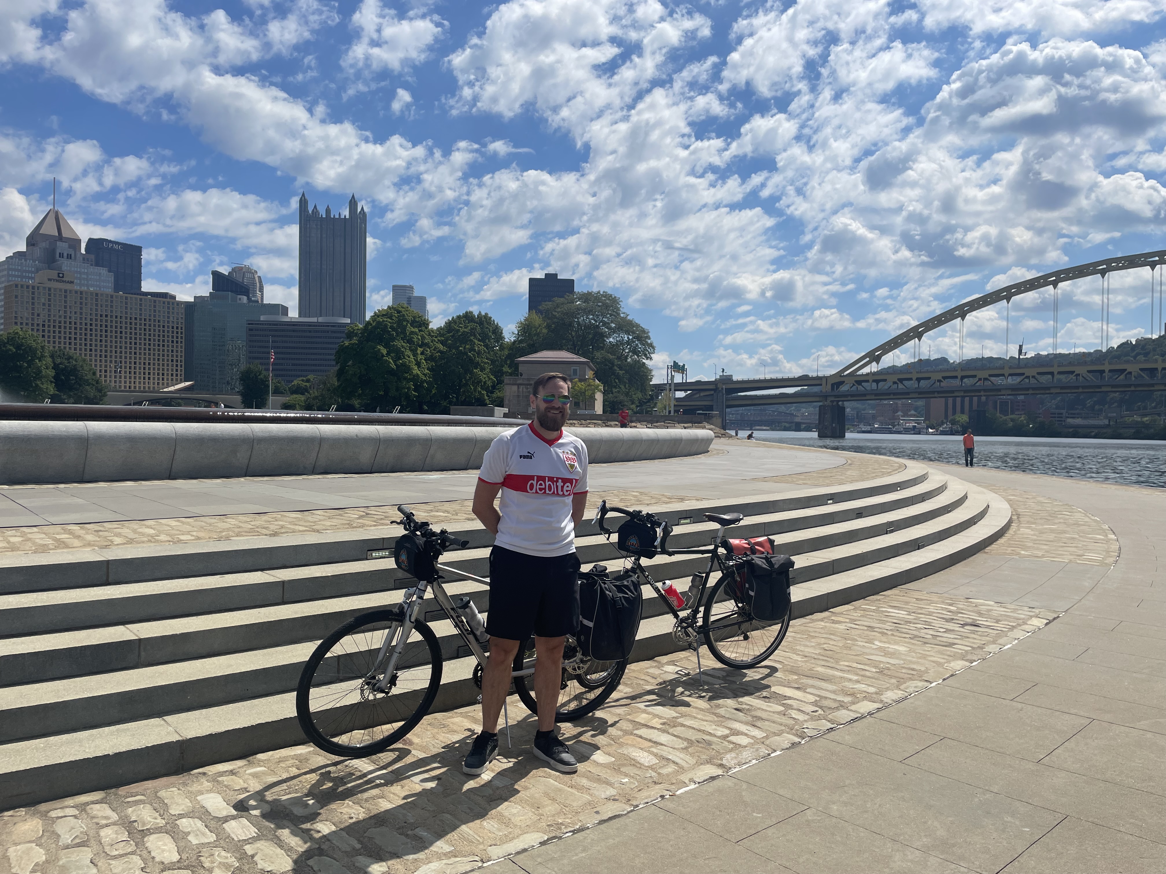
The GAP Trail out of Pittsburgh meanders along the banks of the Monongahela River for the first few miles, sandwiched between the water and a series of surface roads and highways choked with the constant drone of cars. Pittsburgh and its suburbs reveal themselves between the bridges and highways, a hodgepodge of active and abandoned industrial plants and pockets of redevelopment of varying quality. It is easy going on the bike, smooth stretches punctuated by the occasional traffic light making for a pleasant cruise along the riverfront trail. The GAP follows the path of a number of old railroad lines that once hauled coal out of the region, steel sinews tying the labour of Appalachia with more distant markets. The activity continues, even if somewhat abbreviated, to this day and train whistles would periodically echo over to us from the opposite side of the river.
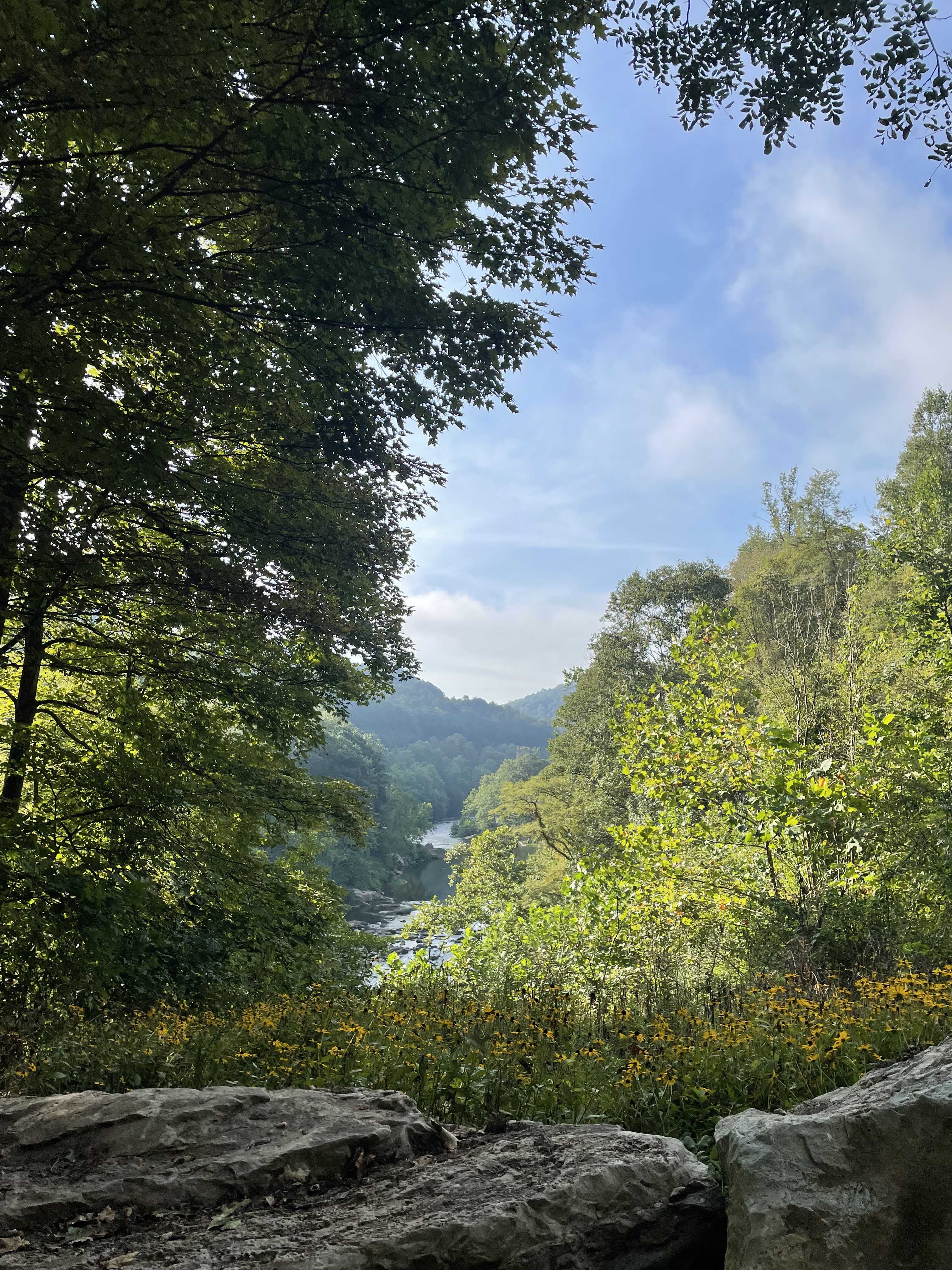
This landscape continues, tracing the river bends, until reaching the faded town of McKeesport, whose downtown is a grim outpost of fields and abandoned buildings where the GAP branches off up the even more-difficult-to-say Youghiogheny River. We would pass through a small town from time to time, but most of the settlements were perched back above escarpments, hidden from view, and the trail gave way to a broad, smooth gravel path through the woods. It follows a gentle, barely noticeable grade, an unhurried climb to crest the Alleghenies that must have been torture for surveyors once upon a time. It was a pleasure to swap out the rumble of car traffic for birdsong and the soft, earthy crunch of gravel being rolled over. Every so often the trees would give way to views of the river valley, which pulled double duty as convenient rest stops to put down some Gatorade and a granola bar.
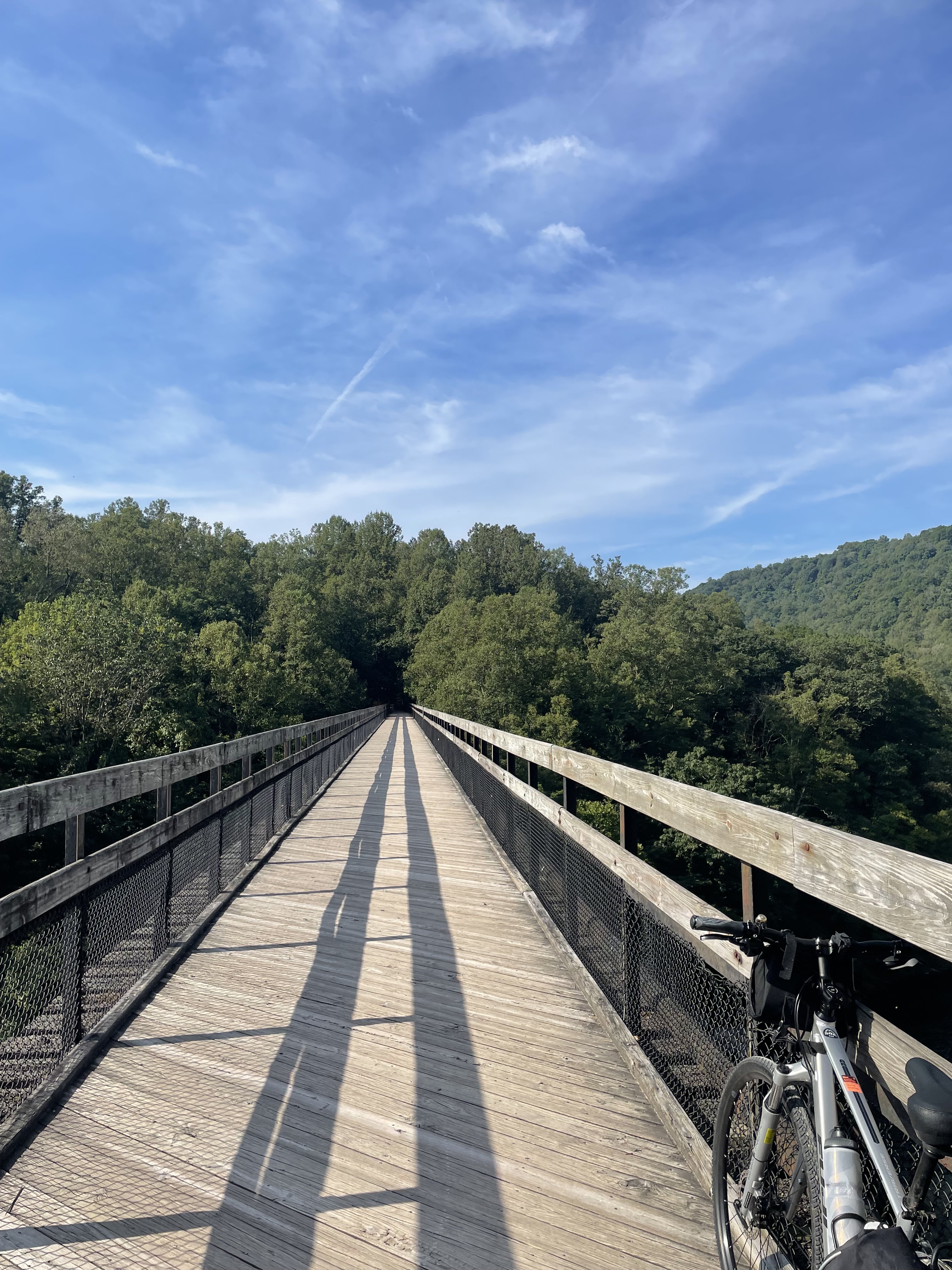
Past McKeesport, the number of people on the trail dropped a lot, with fewer and fewer folks out for a daytime ride or walk. Now and then old railroad viaducts would appear, guiding us across small valleys or to switch riverbanks. Each one had similar elements – a heavy steel structure and old rail ties underneath new wooden planking, creating a rhythmic roll for the bike paired nicely with open views of varying drama. Due to our unplanned late start, we rode fairly hard and took only short breaks, making our way into Connellsville in surprisingly good time. The main drag in town was nearly a total wash, but we eventually were able to tuck into one open restaurant for a well-earned dinner before promptly passing out around 8pm. The early bedtimes and deep sleeps became a feature of the journey, daylight hours were important for the trail and what was there to do at 9pm in these small towns anyway? More important than dinners or bedtimes, we had answered the first big question on my mind: we could do it. Now came the second big question, which would wait til morning to be tested: could we do it again?
Day two of the ride began with a hotel continental breakfast (one of the sadder phrases in the English language) where we compared and compiled our physical state after the first 100 km. Aside from a bit of tiredness and a creaky Achilles heel, we were in a good space. My Achilles problem lingered throughout the trip, but lowering the seat slightly managed to minimize it to a minor annoyance and it is doing fine now. Tires pumped back up, we rolled out of Connellsville. This day was our biggest climb, a total elevation gain of 400m (or 1300 ft.), as we approached the high point of the ride.
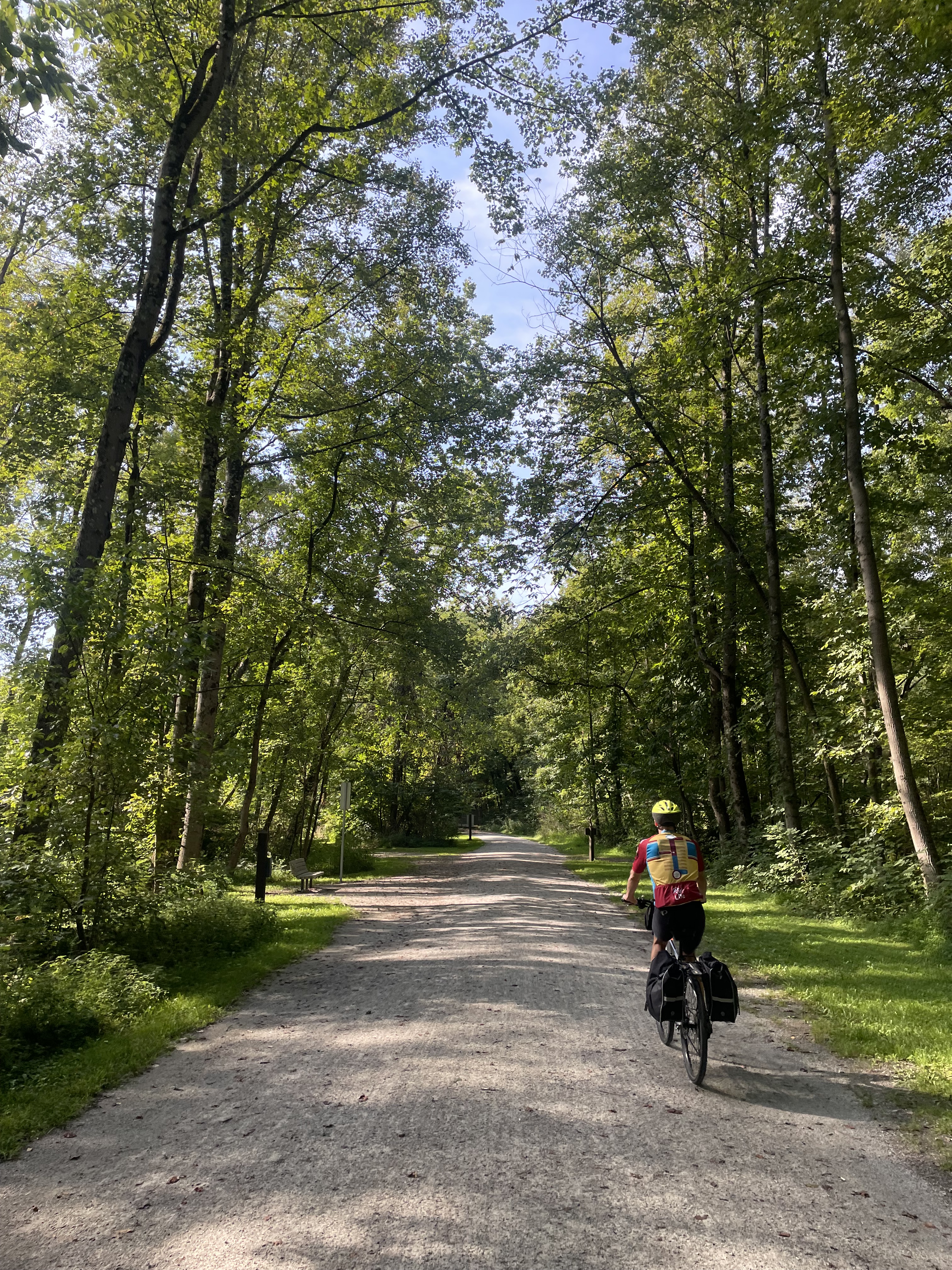
The trail was quiet enough now that the few times we encountered other riders, we would usually exchange small talk, the informal induction into the cycle touring social caste. Otherwise the wide trail made it easy to talk as we rode, to listen to music, or just pedal in silence through the wilderness. It was freeing to think that the only thing we had to do that day was ride our bikes, to get to the next stop in Meyersdale before sundown. Our early progress was good and with more time on our hands today, and we treated ourselves to lunch on a veranda wrapping an old Victorian house in the town of Confluence. The parking lot here consisted of several large bike racks, stuffed to the gills with bikes and e-bikes. The latter seemed to be a favourite of the pensioners enjoying brunch, who made the vast majority of the diners and let me feel younger than I deserved. This meal was also our last view of the Youghiogheny River, where we left it for the yet smaller Casselman River, pushing deeper into the Alleghenies and farther from the trappings of the big cities.

An hour or so later, the GAP passes through the tiny hamlet of Rockwood. Here, at the edge of a gravel lot, local entrepreneurial types have repurposed an old shipping container into a makeshift store with an assortment of Gatorades, water, snacks and ice cream; cash-only. It turned out to be the only such venture on the trail, surprising in the summer peak, when any lemonade stand would do brisk business if properly situated. In Rockwood, this shop was staffed by a grandmotherly woman, who broke off her conversation with a local to greet us and give us the rundown on her wares, inviting us to pin our hometowns on a map of the US. Buddy’s home in Tucson already had a number of pins crowding it, but Vancouver was untouched and I got to put in the first marker. This was the first of a number of times where being Canadian brought more polite excitement than I’d ever experienced – it seems most folks riding the GAP live within a day’s drive of the trail.

We pulled into Meyersdale in the afternoon, tired from the day and ready for a shower and a nap. In the end, the climb that I’d been worried about wasn’t bad at all. It was spread over so many miles as to be scarcely noticeable. We found a local restaurant where we each ordered a pizza and a few bottles of Yuengling, Pennsylvania’s own beer of choice and a regional staple of the Mid-Atlantic. I didn’t realize how hungry I was until the entire pizza in front of me was nearly gone. I had thought that there’d be some leftovers for breakfast but six-plus hours of cycling had built a bigger appetite. It felt good to eat, to sleep, and to answer big question #2. The next day would be the halfway point of the ride, and aside from a short bit uphill to the Eastern Continental Divide, meant that it literally was all downhill from there. A good omen, and we were both feeling more confident now with two big days behind us. Onward to Maryland.
