
Last year, deep in the years-long pause brought on by the pandemic, riding my bike was my sanity measure. I did it a lot, it made for a guilt-free outing from the house around Vancouver but eventually each bike route became repetitive after several dozens of rides. Looking for something different, and looking ahead to better days, the internet led me to the GAP Trail (shorthand for the Great Allegheny Passage), part of a seamless off-road connection between Pittsburgh and Washington DC, a journey of 560 km (about 350 miles). The seed of that idea was planted, and it continued to germinate until this spring my old friend Buddy and I resolved to take it on. A few days and a few Zoom calls later, we had arranged a flurry of hotels, flights and bike rentals. It was time to wait…and to train. Now my rides around Vancouver had a purpose.
Fast forward six months later and I was on the red-eye to Pearson, part of an airport two-step to western Pennsylvania. As fate would have it, my friend Josh and his partner Nicki, based in Toronto, were headed to Pittsburgh as well and kind enough to take me along, literally, for the ride. We made good time to the border and were pushing through Buffalo in short order when I got a text from my airline. My second leg flight, which I’d long opted to forgo, was being punted five hours later. This affirmed my decision to skip that flight, and we motored along the southern edge of Lake Erie before turning south into the intensely green Allegheny Mountains. Pittsburgh is nestled in these unending green seams, its downtown appearing seemingly out of the forest not long after. It makes for a dramatic entry that few cities I’ve been to in the US or Canada can match.

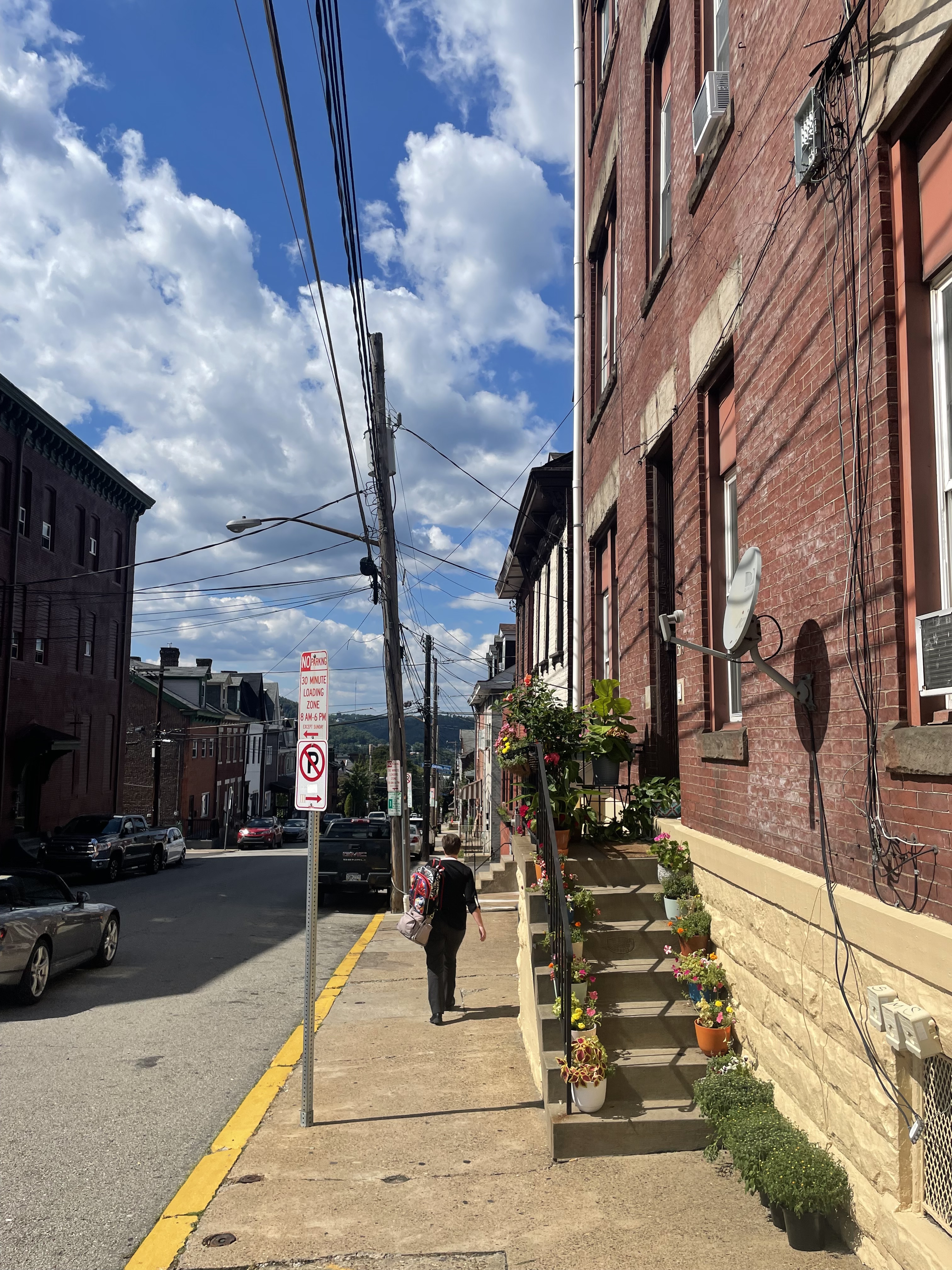
I had reams of good advice on what to see in Pittsburgh and far too little time, so opted to relax and enjoy the time with friends wandering from Bloomfield to Lawrenceville along a stretch of Liberty Avenue, popping into a few bookstores and sitting down for lunch and a sunny patio beer. Pittsburgh is considered a city of neighbourhoods, a somewhat trite but true cliche. It is classically 19th century, gridded streets at occasional odd angles scaling the many hills and small lots packed with homes and businesses. Many of the buildings feel substantial, using brick, stone or similar heavy materials that lend a certain weight to the city that Vancouver’s glass and concrete doesn’t quite match. To really do justice to the city would require far more than the 24 hours or so I had, so I won’t attempt to encapsulate it here save to say that it is well worth the time to see.
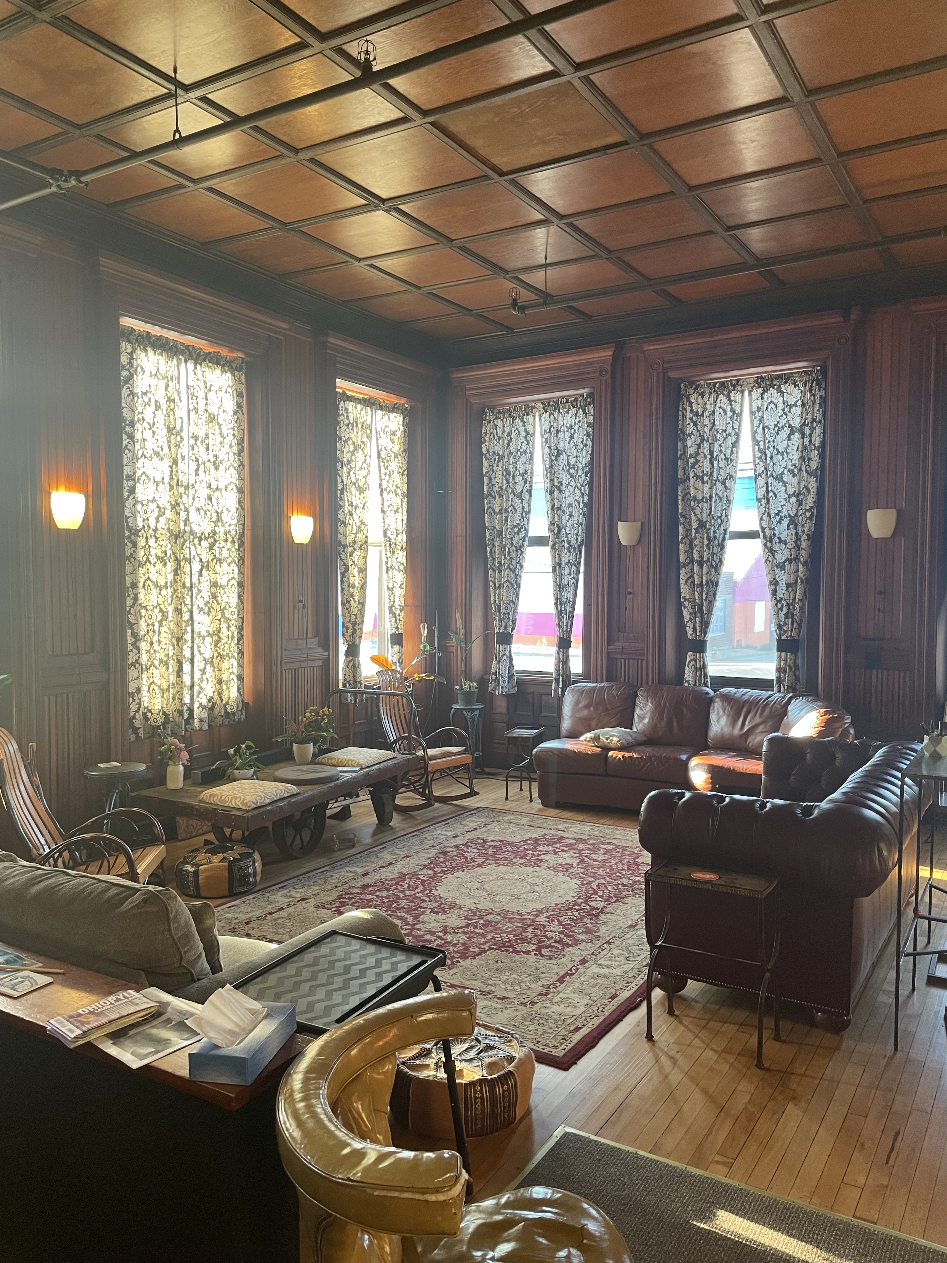
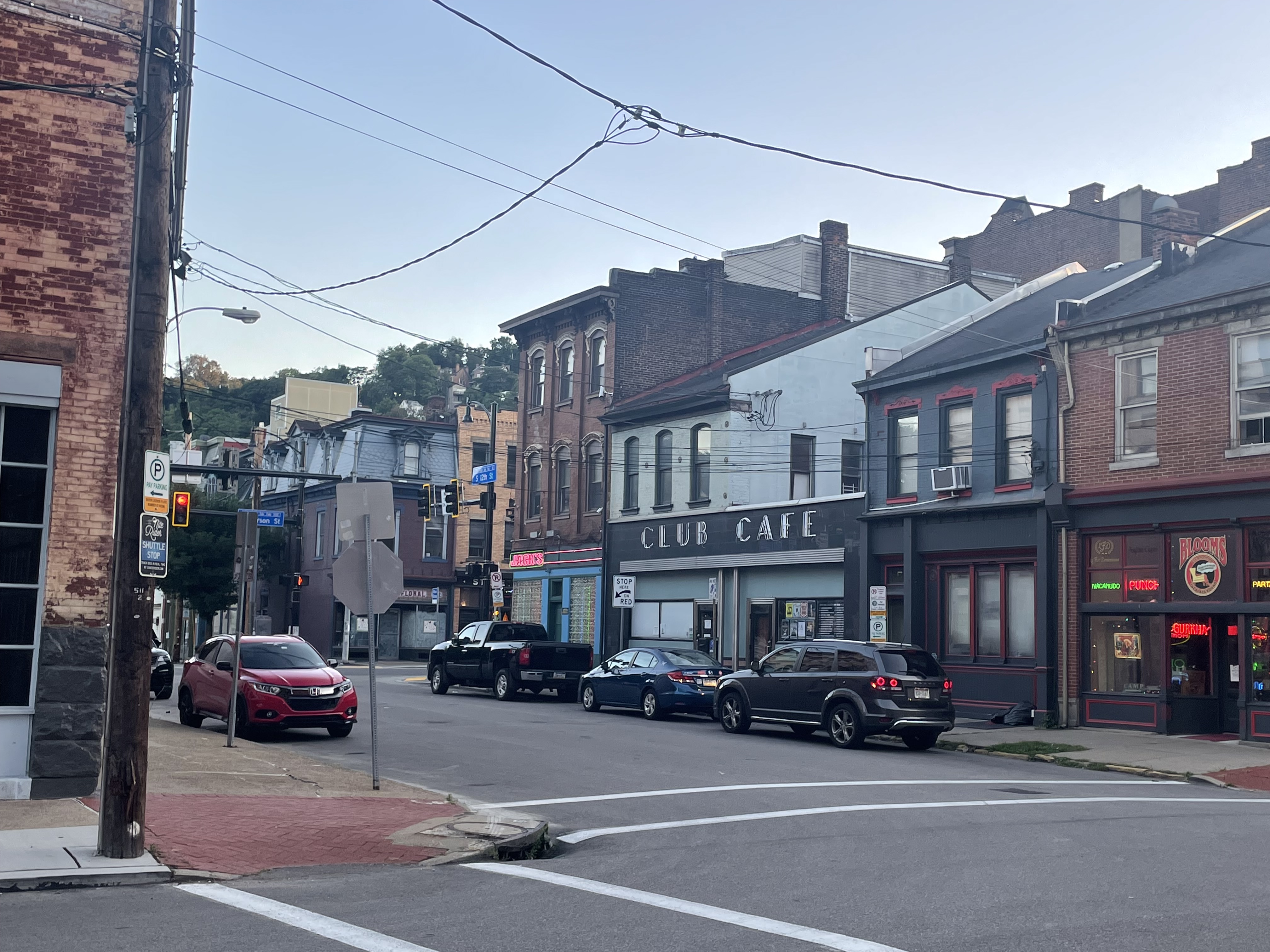
I had arranged lodging for myself at the edge of the South Side Flats, which is, unsurprisingly, a flat area south of the Monongahela River from downtown which stretches out along Carson Street, the main commercial drag. The inn is, like so much here, a building repurposed from a past life as a wrought iron pipe factory, though you wouldn’t guess that from its comfortable, old school common room and relaxed vibe. Buddy’s flight into town was delayed, so instead of making progress to Pittsburgh, he was punted the wrong direction to LAX, with an added flight and substantial delay. Now he was due in on the next morning, hours after our ride was to have begun. We pivoted, figuring that, barring any other complications, we could still keep the planned bike ride on track. But we would have to see how it played out.

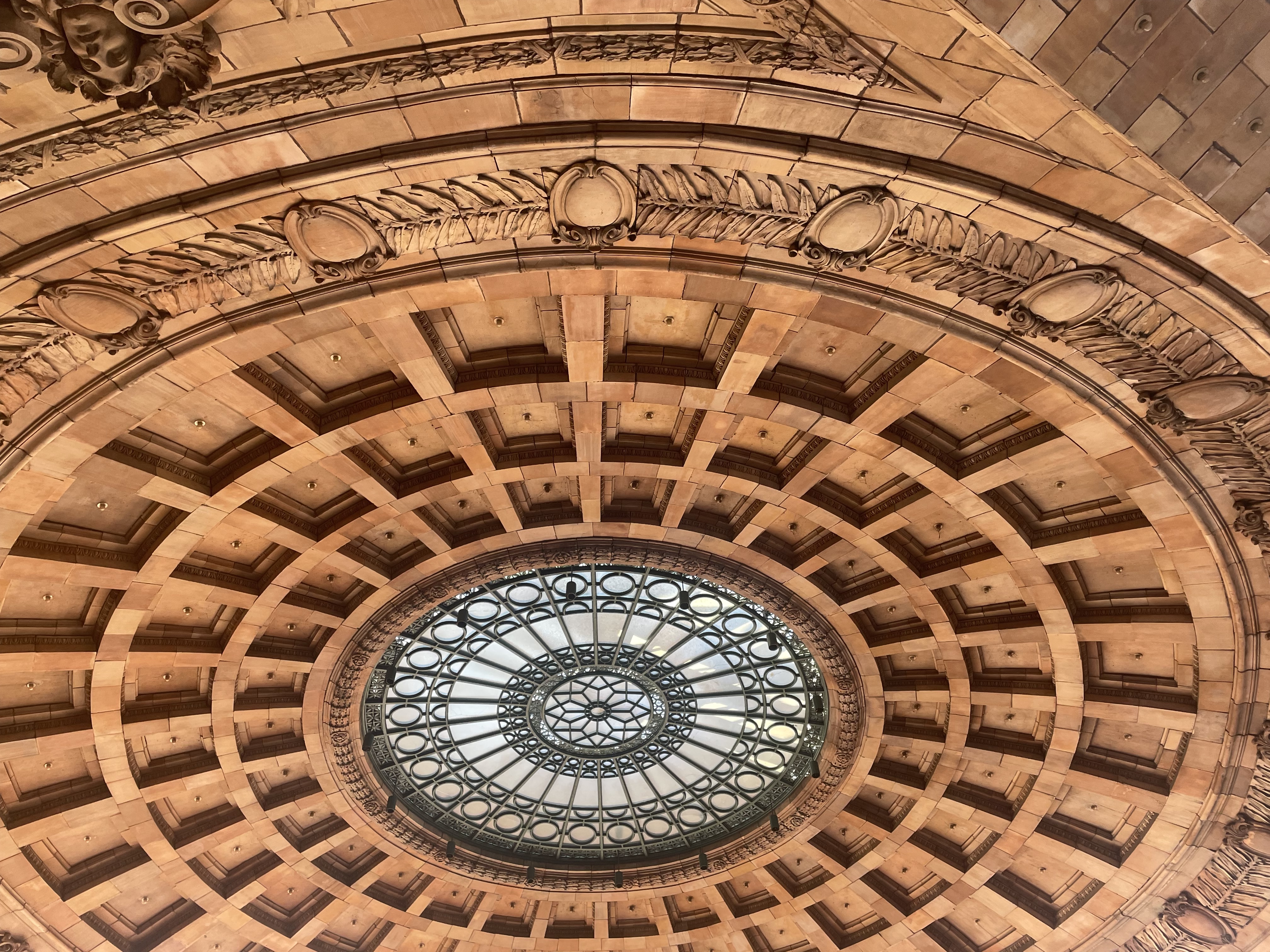
Trying to make the most of the unexpected delay, the next morning I woke early and decided to explore the city a bit more. Again I was stymied as I approached the Monongahela Incline, a steeply sloped funicular train climbing the slopes to the Mt. Washington neighbourhood, which was down for maintenance. I instead opted for a quick tram ride downtown but was starting to feel a bit snakebit, as if these complications were a bad omen for the bike ride to come. It helped a bit that it was a clear, sunny morning and that I was able to caffeinate shortly thereafter at Market Square, a lovely European-style plaza in the heart of downtown where a farmers’ market was being set up.
Downtown Pittsburgh, like the rest of the city, boasts a plethora of robust buildings burnished by time with a pleasant patina. The bigger buildings call back to its days as an industrial powerhouse, the robust heart of the American steel industry, with the skyscrapers to match this swagger. Today the downtown feels somewhat empty, or perhaps just oversized, compared to the number of people on the street. A former Kaufmanm’s department store, occupying the better part of a city block, sat vacant with space to lease, though a portion had recently been reborn as a Target. This seemed as good a summation of Pittsburgh today as anything else: a proud city with a storied legacy but still on the mend from the cumulative wounds of sprawl, white flight, and deindustrialization.
Buddy did make it to Pittsburgh in the end, his experience of the city mostly consisting of the car ride from the airport to the bike shop downtown where we met up. Golden Triangle Bikes, a seasonal outfit underneath an elevated tram bridge, adjusted our bikes and had us ready to pedal within half an hour. We began with a brief backtrack to Point State Park, the tip of the triangle that is downtown Pittsburgh and the official starting point of the Ohio River, where the waters of the Monongahela and Allegheny Rivers first merge. The Ohio carried on to its meeting with the Mississippi hundreds of miles away, oblivious to us, secure in its mission. We would be going the other way, backwards down the path of America’s westward expansion, along the rivers, railroads, and canals that opened vast swathes of the country to European settlement.

I honestly wasn’t sure what to expect from the ride that lay before us. I had done a few modest bike touring trips near Vancouver, but never for so many days or over such a distance. I’d biked several times a week for months, going so far as to set a new personal best of 105 km one day. For this trip, we would need to average that distance and more. And all in an unfamiliar place with only a vague idea of what to expect. The question that stayed in my head was a simple one: “Can we do this?”. I wasn’t sure but there was only one way to find out. We pointed our bikes east and started pedaling.
